
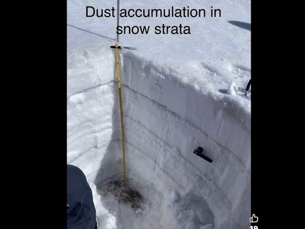
A Testament to Air Dispersion
Just like a white layered cake with grey/black frosting.
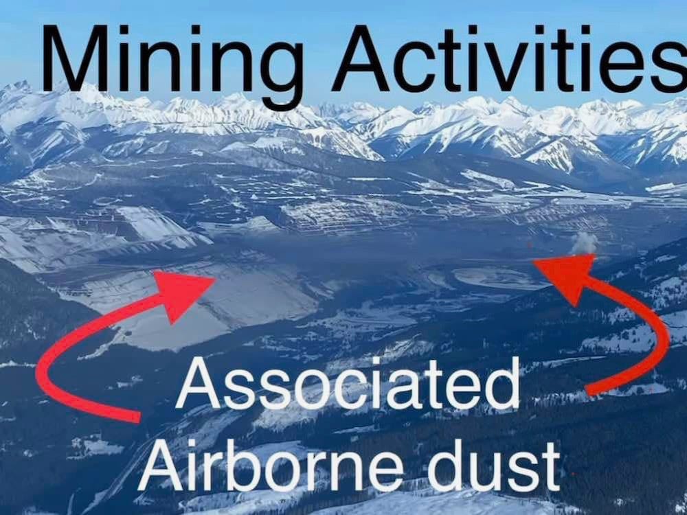
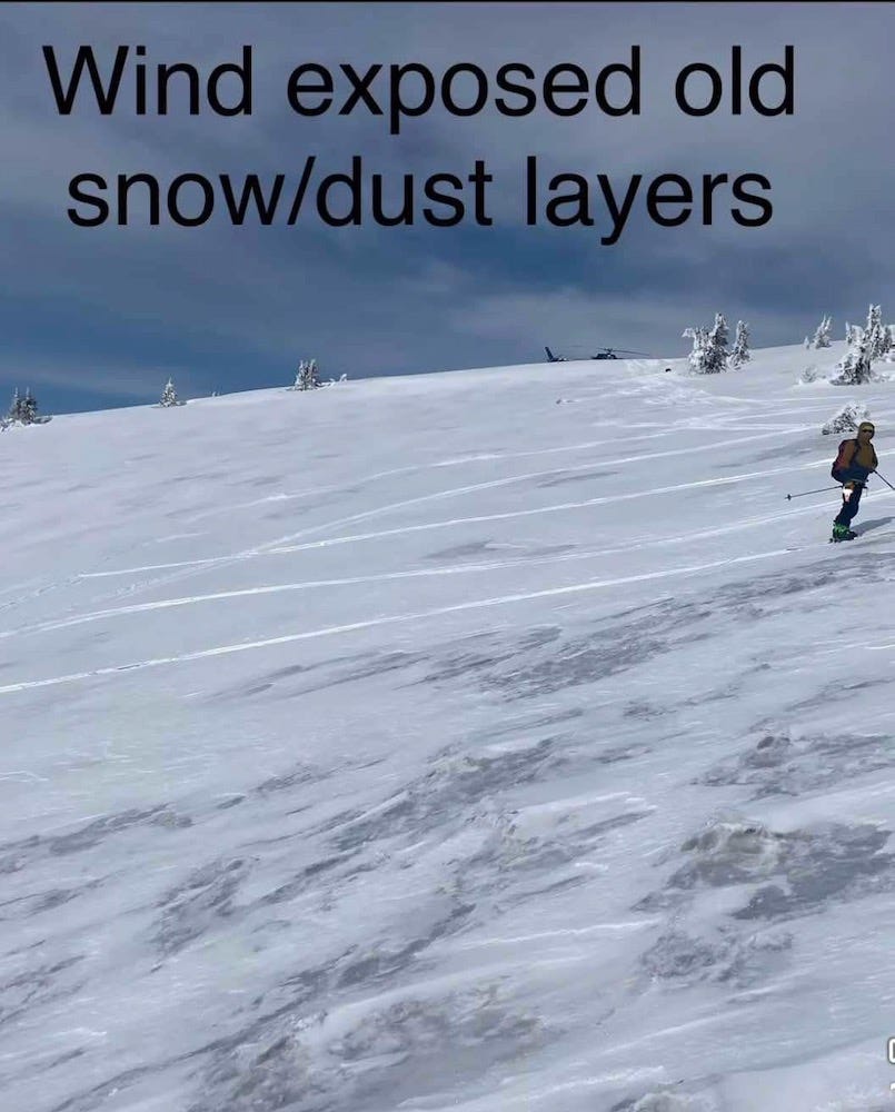
This posting is more of a pictorial essay on the air dispersion of coal dust. All of the photos were sent to me via a friend of a Fernie ski guide who in 2024 chronicled the evidence of coal dust layering between snowfalls in the Fernie area.
These images will be self-explanatory.
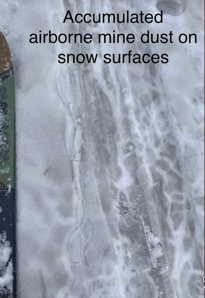
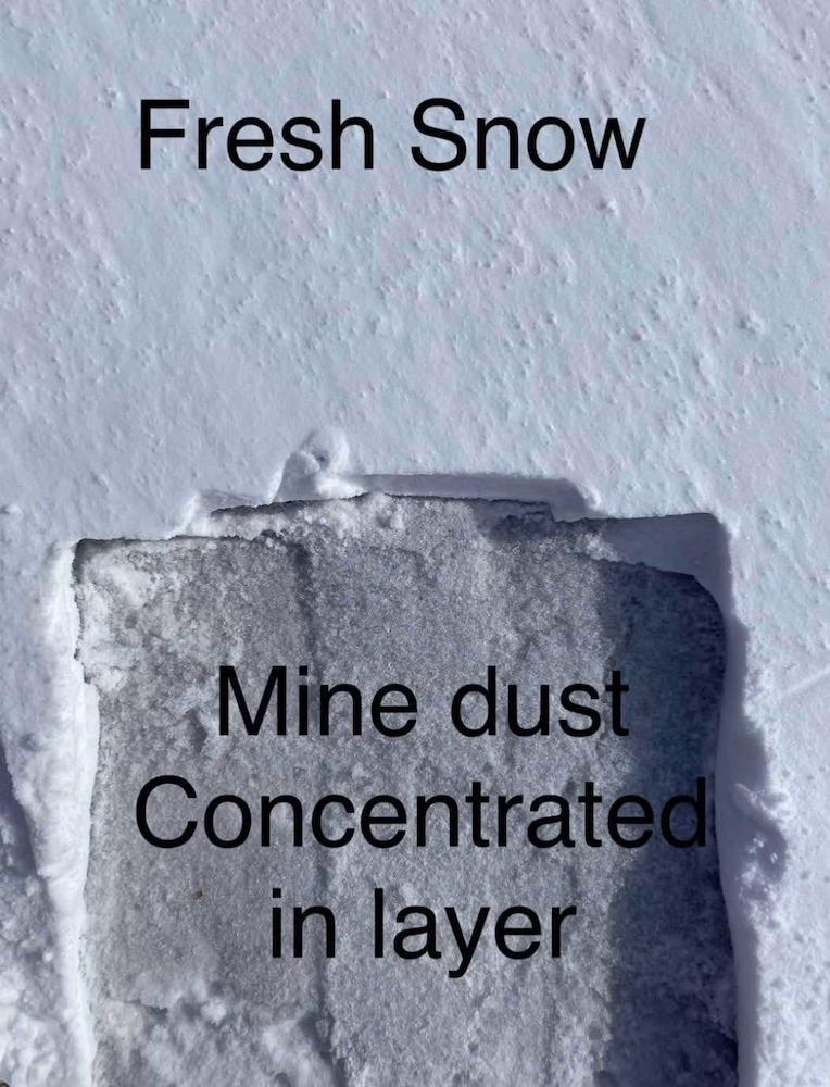
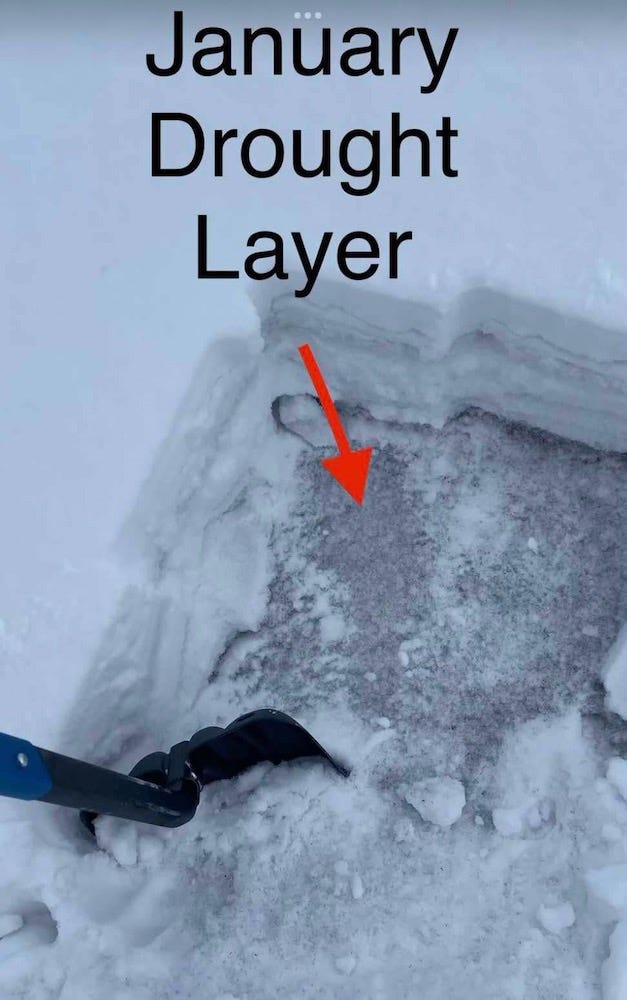
A snow pit normally used to analyze avalanche potential, suddenly revealing so much more.
So given that this is representative of part of one snow season, just think about years of ongoing accumulation to the land and waters in our high wind area of SW Alberta.
The detrimental effect of airborne dust from the Elk Valley on Window Mountain Lake wasn’t nearly as evident for many years because of it being a water body which isn’t really noticeable until the questions start to arise such as, where have the fish gone?, leading to water analysis.
I would think that anyone would be able to reason through the logic of how subject to this contamination we are.
It goes without saying that this should be a great concern for anyone growing crops, ranching livestock, growing a garden, recreating, drinking water, or simply breathing. However, I’m sure that certain readers of that comment will chastise me for fear-mongering once again.
Thanks for reading.
I totally agree. This is what we are facing. It's reality. Not fear-mongering. You know, just science. Oh, yeah, that's a thing. Sigh.
That layer cake photo should go to every member of the UCP caucus. Would you eat this Chelsae? Its really yummy.