
Alberta's Example of BC's Elk Valley
For examples of the devastation of coal mining our focus is often on the Elk Valley in BC. We have our own, made in Alberta version of the Elk Valley in the McLeod River watershed and the Coal Branch. The story of the devastation created by coal mining in the McLeod watershed, especially the legacy of water quality concerns. might be a warning to us in southern and central Alberta. - Lorne Fitch
Requiem for a River—The Tortured Life of Alberta’s McLeod River
Lorne Fitch, P. Biol.
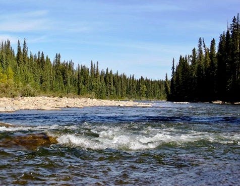
One wonders if a river sometimes curses its geological underpinnings. When other rivers were given diverse attributes, the McLeod River was given coal, underlying most of its headwaters.
If the coal had been left in place, buried, the McLeod would not have suffered so many indignities. But from the early 1900s up to the present day, we have dug and tunneled under and blasted the tops off mountains to wrest coal from its origins. The mayhem left behind after more than a century of coal mining influences the watershed and especially the watery inhabitants.
One could blame the Canadian Geological Survey and D. B. Dowling, a noted member of it for writing in 1908, “Higher grade steam and coking coal may be obtained from more distant fields, to which approach is more difficult, since they are situated behind high, rocky ridges. On the McLeod the upper part of the coal-bearing horizon was observed to have about 20 feet of coal seams.”
This piqued the interest of many who saw potential for a source of “steam” coal to fuel steam locomotives. But the area needed a railway to open up this inaccessible area, soon to be known as the Coal Branch. A branch line of the Grand Trunk Pacific Railway was constructed in 1911, south from Edson to Coalspur, where mining began in 1912, and on to Mountain Park.
A booming market for coal eventually brought 26 companies, operating on 80 coal leases. This translated, from 1912 to 1960, to at least 22 underground mines and 11 surface, strip mines. Mining, of one form or another proceeded in all of the McLeod River headwaters at Cadomin, Sterco, Mercoal, Luscar and Mountain Park. Most crashed in the late 1950s when railways switched to diesel locomotives.
Mining resumed in 1969 at the old Luscar site. Others followed including Gregg River, Cheviot, Coal Valley, McLeod River and McPherson (Vista) strip mines. Compared to earlier mines, the footprint of these mines are immense. After mining life spans of two to three decades, the Luscar, Cheviot and Gregg River mines are being “reclaimed” while the others remain somewhat operational, retired or suspended. As the future of coal dims, in a world beset by greenhouse gas emissions from the burning of fossil fuels, these mines are sowing the seeds of their decline.
The headwaters of the McLeod River and its upper tributaries the Gregg and Embarras rivers hosted mines (underground and surface), railways and company towns. Each mine had a loading tipple, sorting facilities, power houses and railway tracks all squeezed into narrow valley bottoms.
Archival photos show burned forests, probably sparked from locomotives, and ones stripped of trees for mine props and other mine infrastructure. Old photographs of floods and landslides are commonplace, likely due to forest removal for mining.
Piles of waste coal and the occasional concrete pillar from these underground mines provide some of the only landmarks of past endeavours. All are situated in tight valleys, on the edge of rivers and streams. None of the sites were ever reclaimed, in any sense of the term.
Every rainstorm, every snowmelt allows a bit more sediment to bleed into the water, filling in the nooks and crannies of the substrate where aquatic insects live and where trout find refuge. Some sites have been doing that for over a hundred years, an unfortunate legacy. Some may continue to contribute coal fines for another century or so.
Mine adits, the entrances to dozens of underground mines, locations now largely forgotten, probably still leak water of dubious and unknown quality from a labyrinth of flooded mine shafts.
Coal mines, the surface strip variety, were located (and continue to be sited) in steep terrain where gravity endlessly exerts force. The procedure was (and is) brutal where heavy machinery (coupled with explosives) totally removed soil and rock overburden and then the coal beneath.
This has transformed steep landscapes from being unique, sensitive and relatively stable ecosystems to ones blasted, shattered, excavated, cut and dumped into unstable piles of rock, dirt and dust. The areas are highly vulnerable to erosion, at the mercy of rain, snow and wind, both during the mining phase and well beyond.
All of these mines have had some sort of acute or chronic operational or engineering failure of settling ponds, roads, conveyance systems or mine surfaces often resulting in catastrophic spills of coal, sediment, tailings or something else into receiving streams.
Dozens of streams have disappeared into the maw of coal mines—named, unnamed, intermittent and temporary ones—never to reappear. The latter two systems, often dry at least on the surface, conveyed subterranean water, bolstering flows in larger, named streams. They’ve been ignored and underrated.
Perhaps hundreds of kilometres of streams have been permanently buried, dislocated, truncated and diverted, reflects Carl Hunt, a retired regional fisheries biologist. Little attention has been paid to these little streams and their contribution to larger aquatic ecosystems.
Mining companies provide photos of reclaimed surface mines as green meadows amid rolling hills, with just a few, elongated blue ponds with bare headwalls. These are sylvan scenes taken at very desirable locations to extol the ability to reclaim former holes in the ground.
What is rarely shown is the overall scene of utter devastation created by a surface coal strip mine. And, what is unseen, unappreciated and mostly unmanaged are the elements leaching out of the overburden, blasted and shattered and dumped to expose the coal seam.
Sediment, nitrates, metals and other ions are liberated during mining. Selenium, antimony, cobalt, lithium, manganese, molybdenum, nickel, strontium, thallium, uranium and many others are released for decades by the weathering of the shattered caprock overburden. This produces a veritable witches’ brew of toxic chemicals, either individually or in synergistic combination.
On the bright blue, sunshiny days when the photographs are taken of the efforts to make a black mine site green, it’s hard to see the effects of rainfall and snowmelt on a landscape that has lost its ability to trap, store and slowly release water. Compacted mine spoil coupled with the loss of intact forest speeds up runoff and erosion. The water is gone in a flash, leaving nothing for the rest of the year. Downstream fish wonder at the sudden influx of muddy water, followed by a dribble, or dust.
These high elevation areas are difficult, if not impossible (in any sense of relative time) to vegetate and reclaim to any degree of a pre-existing condition. Even the coal companies recognize the hurdles of reclamation with: “Elevations range from 1,400 to 2,000 metres and soils are generally thin and rocky. The climate is severely influenced by the mountains and the elevation; snow is common in all months of the year. Strong Chinook winds blow in the winter, melting and moving snow and creating a very difficult growing environment for plants and young seedlings.”
While it can be argued that “wildlife diversity is maintained by an ecosystem approach to reclamation that restores pre-mine habitat condition, replaces habitat function, and exchanges certain components for others of similar benefit,” this is not the case with native fish mitigation. The best they have been able to do is repurpose unclaimed mine pits into trout ponds.
The value of these pits for fisheries mitigation is questionable and probably useless. No spawning areas are available, requiring regular stocking to support a fishery. Native trout populations and their habitats are not replaced in any equitable way. Plus, natural, unimpacted streams were found to be 10 times more productive for trout than mine pit lakes. Research also has shown selenium bioaccumulation in trout which poses a risk to human health through consumption of these fish.
Fish are the ultimate arbiters of the effects of land use, since everything that happens in a watershed inevitably flows by and sometimes through a fish. Arguably the McLeod watershed is the epicentre for the Athabasca rainbow trout, Alberta’s only native rainbow trout (the others are transplants from elsewhere).
When R. B. Miller, Alberta’s first fisheries biologist, surveyed the watershed in 1948 he commented that, “Rainbow trout are present in incredible numbers in every little creek and beaver-dam, in the larger tributaries and in the main McLeod.” He also found bull trout and Arctic grayling throughout the streams.
Now Athabasca rainbow trout are designated as Endangered throughout the Athabasca watershed, including the McLeod. A perfect storm of land use, including coal mining, has led from “incredible numbers” to nearly gone. There has been a 92 per cent reduction in fish biomass downstream of coal mines in the upper McLeod watershed.
One can blame the lack of any early environmental laws, the exuberance to extract wealth from the watershed and the enduring impacts of cumulative effects. Part of the demise of the Athabasca rainbow trout populations was the antipathy shown them by anglers and even biologists like R. B. Miller. Miller derisively commented that, “The low temperature and poor food supply have converted these Rainbow trout into a dwarf race of absolutely no sporting value…”
For populations of these feisty little trout, passing the evolutionary test of surviving and thriving in a rigorous and challenging environment wasn’t enough. They also had to be big enough to catch. These trout are not dwarves, or stunted, but grow to the full potential of cold, unproductive waters, in a short season.
It’s the unseen legacy of coal mining, especially selenium, that will plague these little trout and their relatives the bull trout and Arctic grayling into the future, worries Connie Simmons, former member of the Athabasca Bioregional Society. Selenium is an element vital in small amounts but toxic in excess. It doesn’t take much to damage the liver, kidneys and heart of fish. It can reduce the number of viable eggs a fish can produce and lead to deformed spine, head, mouth and fins. It bioaccumulates in aquatic insects, essential fish food.
An Alberta government document states: “Current assessments indicate there is no risk to humans who drink water or eat fish containing excessive amounts of selenium.” But, this source has long been recognized for its muted, industry-friendly response to environmental issues.
Bill Donahue, a noted environmental scientist and colleague of David Schindler, looked at mining related selenium contamination of McLeod waters from 1990 through 2016. He found that selenium levels averaged almost six times higher in the McLeod River downstream from the Cheviot mine. They were nearly nine times higher in the Gregg River and 11 times higher in Luscar Creek, despite years of reclamation. Selenium levels in all the samples from the Gregg River and Luscar Creek exceeded those considered safe for aquatic life. Levels were nearly four times higher in the Gregg River and nearly nine times in Luscar Creek. The level was exceeded in about one-quarter of the McLeod River samples.
The verdict is still out on the downstream effects and legacy of mining well beyond the headwaters and into the Athabasca River. There is a maddening unwillingness in each new mine proposal not to look past the mailbox of their own endeavour to the wider watershed. Each proceeds based on an assumption no other mines exist and theirs is but a minor inconvenience to fish, wildlife, water quality and scenic aspects.
Mine proponents and their apologists (including those from logging and petroleum interests) say the problem with environmental interests is they keep interfering with the legitimate, wealth-generating blessings of a conflicted government operating with a free market ideology. This hampers economic genius through unnecessary rules and regulations, with onerous monitoring, mitigation and occasional legal charges. Maybe that’s so, but the McLeod has borne too much.
The trout and the river know the truth about coal mining and it isn’t pretty.
Lorne Fitch is a Professional Biologist, a retired Fish and Wildlife Biologist and a past Adjunct Professor with the University of Calgary. He is the author of Streams of Consequence and Travels Up the Creek: A Biologist’s Search For a Paddle.
Thank you for this.
Every school science/biology/social studies teacher in the McLeod River basin should be sent a copy of this to give to their students along with a map.